
This post may contain affiliate links. We may receive a small commission, at no cost to you, if you make a purchase. Read Disclosure.
The first I heard of the Lost Coast Scenic Drive in Northern California was two days before we arrived. I had heard it was an untouched coastal wilderness so thick and uninhabited only a few dared to go, so of course, I dared.
The government decided some time ago that this region was too treacherous to build any decent roads going through it. While the roads are paved, they are largely left to the elements, and some are undeveloped entirely.
Sounds like an adventure, right?
Lost Coast scenic drive
The Lost Coast Highway scenic drive extends south from Ferndale in California to the south of Shelter Cover.
We mapped out a 107 mile loop from Ferndale along the Lost Coast Headlands and then around to the Avenue of the Giants in Humboldt Redwood State Park.
It would pass through high alpine forests on one side, and the wild Pacific Ocean on the other, as well as passing through the northern edge of King Range and on to the Redwood National Park.
Here is the route we took…
The Lost Coast Scenic Drive Itinerary

Below is our itinerary for the Lost Coast Scenic Drive. The Lost Coast was named after the region experienced depopulation in the 1930s. Rather than try to build the road along the Lost Coast, engineers who designed California’s Pacific Coast Highway, turned inland instead.
You generally don’t need a 4×4 as some of the road is paved, but there are some gravel roads (Mattole Road), which can throw up some stone’s under your wheels.
Mattole Road is 75-miles of this 110 mile scenic drive and has two lanes, but it has a speed limit of 20 miles per hour because the gravel is so slippery and treacherous.
Therefore it’s recommended to get a 4X4 drive car, but you don’t have to. It’s completely up to you and how confident you feel.
It takes a full day to drive the Lost Coast Scenic Drive.
However, the following itinerary is a loop drive back up to Ferndale and we recommend you take two days to complete it.
Stop 1: Ferndale, California
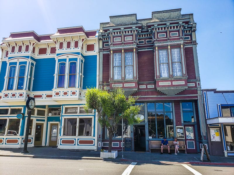 Shop fronts in Ferndale
Ferndale is the town where time stood still. Meander down the main road to find lampost-lined blocks of historic Victorian style architecture that houses various artisans from artists to blacksmith, this is small town Americana.
Its location sandwiched between the Lost Coast and ancient redwood forests makes for a beautiful and tranquil base to explore this Humboldt County region.
You can see why this charming town has been the setting for a few Hollywood movies.
There’s an eclectic mix of independent stores alongside small cafes and fine dining.
A few we loved browsing: Ferndale Arts Gallery, Farmer’s Daughter, Sweetness and Light, and the Golden Gait Mercantile.
Five minutes from the town of Ferndale is a long wind-swept beach, which is great for walking and playing.
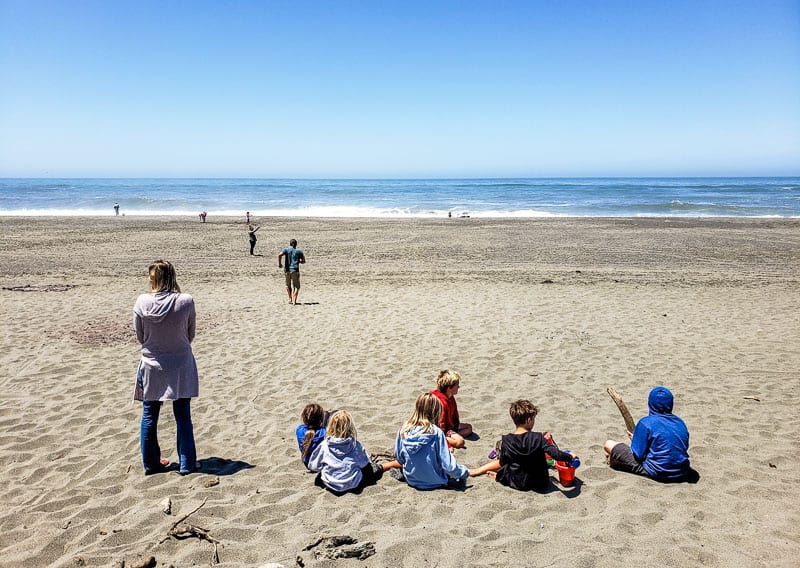 Beach near Ferndale
I wouldn’t recommend swimming in many of Northern California beaches, they are quite treacherous and will have many signs warning you of the very real dangers.
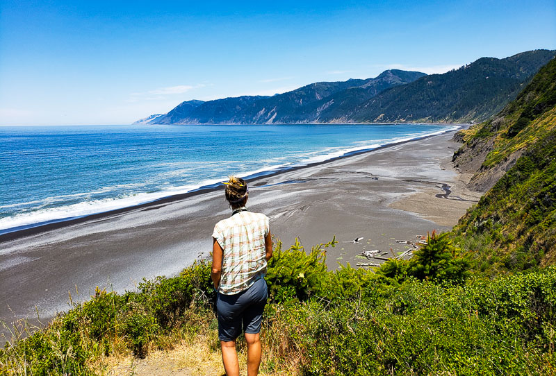
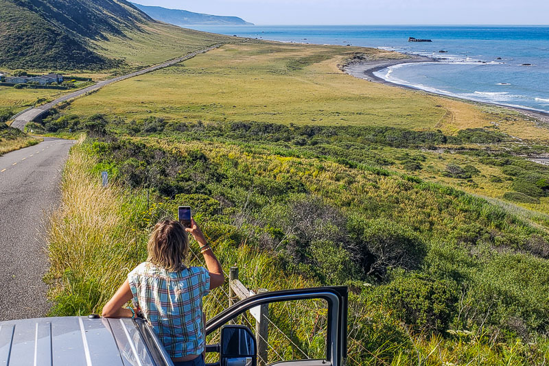
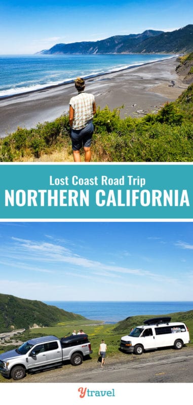
Stop 2: The Lost Coast Headland
 Lost Coast Headland
I kept thinking I could be in Australia or Ireland for much of this journey. I loved driving through the forested mountains, rolling farmlands with views out to the ocean from afar.
It was so verdant and green with a few farm houses here and there and several happy cows chewing grass or sitting on the side of the road quietly watching you drive by.
This area is also known for its abundance of wildlife, including bears and mountain lions.
While we didn’t see the two latter beasts, we did see a few deer and lots of birds. My favorite was Santa’s reindeer’s munching on the grass along the cliff sides in Shelter Cove.
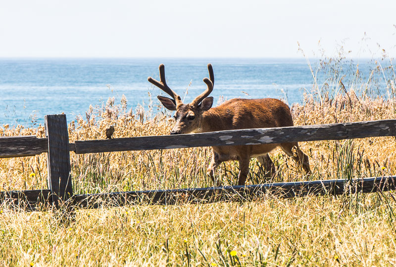
I told you the Lost Coast was magical.
California’s Lost Coast is the most undeveloped and remote area of the California Coast. For much of the coastline, there are no roads at all, and so hiking through thick shrubs and tall cliff faces are your only option for exploring it.
One more fun fact to add to the adventure of a Lost Coast road trip, this area is one of the most seismically active in the country! It sits on the collision of three plates.
Well, you know you’re in California, there is not much you can do about that. Be alert and prepared and take note of evacuation routes and tsunami warning signs.
We were quite rattled the evening before when the sirens went off in Ferndale, for longer than we thought was “just a test.” However, no one seemed to move or panic. I did just silently on the inside.
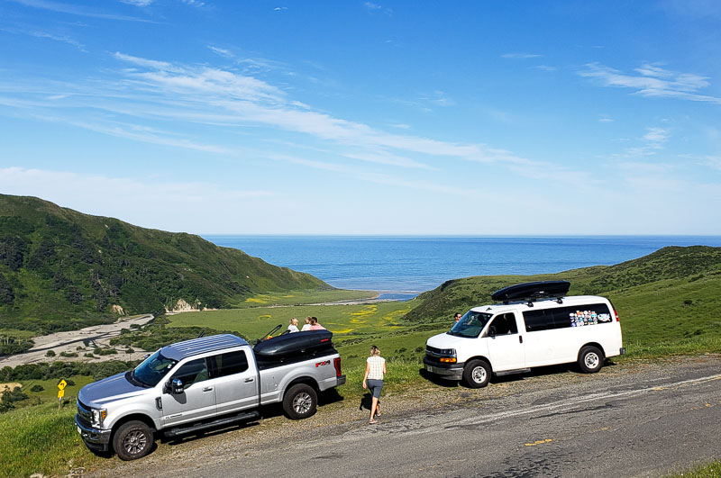
Stop 3: Mattole Road (The Wildcat)
Now the drive really starts. Enter onto the Mattole Road or “The Wildcat,” which rises into the coastal hills.
It’s hilly and windy and surrounded by cattle grazing on the side of the road, so drive slowly and carefully.
After some time you come to the edge of the cliff with spectacular views out over the coastline.
The road then goes down to meet the coast and for the next 10 miles it follows the shoreline. This is the only section of the Lost Coast that goes close to the shore.
Everywhere else the mountains are too high and steep to make coastal roads possible.
Stop 4: Cape Mendocino
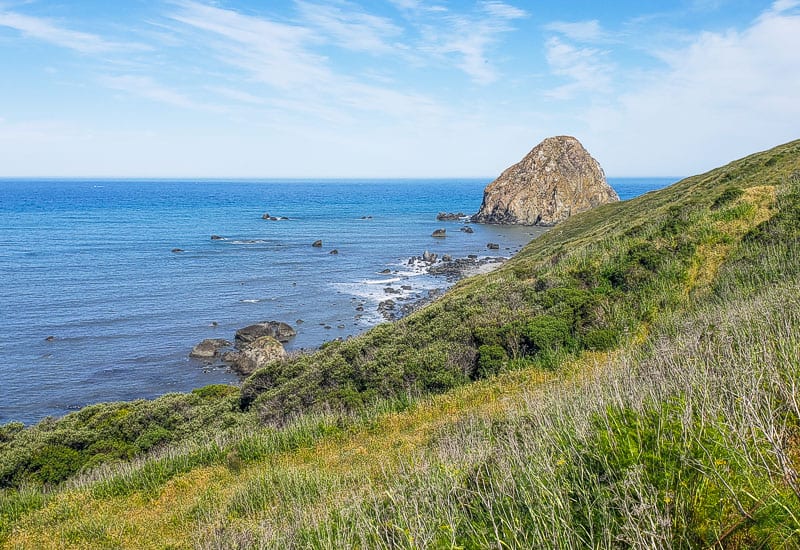
Stop off at Cape Mendocino for views over Sugarloaf Island and Steamboat Rock, and other black rocks jutting here and there.
It’s the perfect resting spot for seals or migrating whales, none of which we saw.
Stop 5: Petrolia
The route then takes you through the Mattole River Valley to the hamlet of Petrolia where you can pick up basic supplies.
There is a shorter road cutting through King Range National Conservation Area, but it’s 4WD recommended, and while shorter in miles Google maps, the 20-mile an hour speed limit and gravel will slow you down.
You can take a detour to the Punta Gorda Lighthouse via a 6-8 mile round trip hike along beaches and cliff faces. Check the tides and be sure you have time!
From Petrolia, we took the longer route along the outskirts of King Range National Conservation Area through a few small villages towards Black Sand Beach, stopping in…
Stop 6: Honeydew
Honeydew is a small hamlet with barely a house or building. You might pass through it completely unnoticed, if it wasn’t for the Honeydew Country Store and Honeydew Hideout restaurant which sit at a junction.
It’s a good place to stop for lunch if you haven’t eaten already.
From Honeydew you can either go inland to the Humboldt Redwood State Park or continue to Black Sand Beach along the Wilder Ridge Road.
We recommend you drive on to Black Sand Beach, and then loop back up to see the redwoods after.
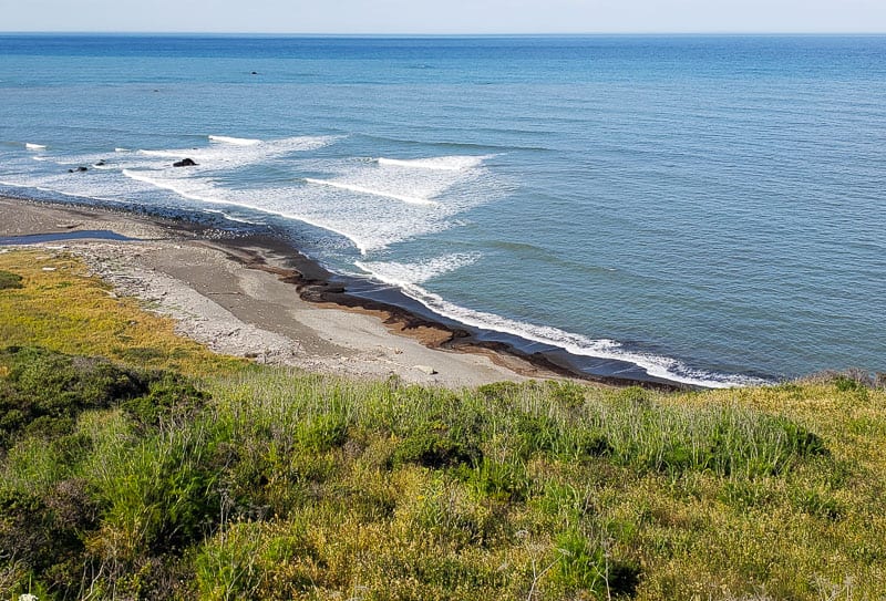
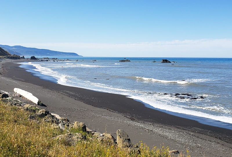
Stop 7: Black Sand Beach, California
 Lost Coast California
We originally decided were weren’t going to bother driving to Black Sand Beach at Shelter Cove because it would tack on an extra two hours to our already long road trip, and were planning on cutting across to see the Redwoods, but we’re so glad we turned back!
It made this trip one of the best scenic road trips in the USA. The area around Shelter Cove is stunning, and I was blown away by its beauty and felt I had been transported to the shores of Hawaii.
Just when you think you’ve seen it all, a steep, windy road (you almost quit and turned off) leads you to this tropical cove.
All the blessings were working in our favor as it was sunny, and warm, and the waters very calm and still, even at high tide. Three magical ingredients that rarely line up in this part of the world.
Unlike most of California, in particular from San Francisco down to San Diego, this area was free from crowds. We practically had it all to ourselves and would be the perfect quiet short trip many Californians can only dream about.
If you are a hiker and adventurer, consider the thrill of the Lost Coast Trail, which takes you along the beach front.
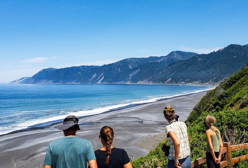
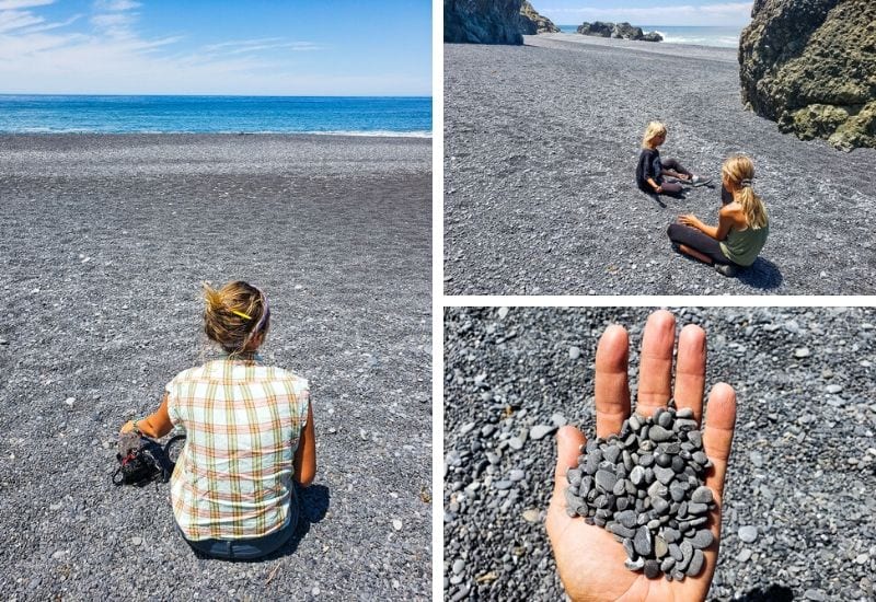
Black Sand Beach was the main attraction of the Lost Coast for me. It was a total unexpected WOW moment.
The sheer mountains sloped down to end on the black sandy cove providing mesmerizing stark contrast between the black beach, the green mountains, the still calm waters of an ocean that in this part of the world is typically quite rolling and aggressive.
The three mile dark pebbly sand is framed by the steepest coastal range in the nation.
The signs from the locals were not shy in letting us know to remain at least 100 feet from the water as sneaker waves are known to creep up and grab people in surprise taking them out into the deep drop offs and strong currents to never be seen again.
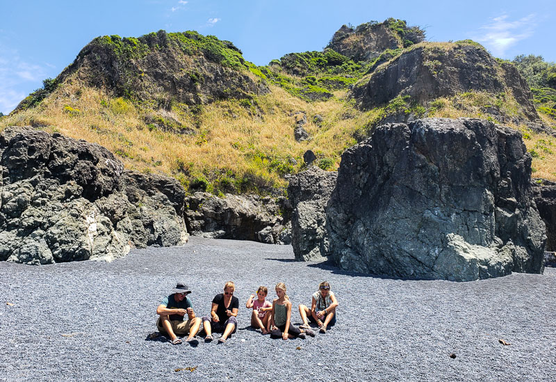
We made sure we honored the locals warning and stayed very clear of the water’s edge, instead choosing to play on the black, pebbly sand that burned our feet and backsides.
There were rocks the kids could climb up and little nooks and crannies to play in.
Start with the view from the parking lot and enjoy the very short trail down to the beach lined with tropical like flowers for a different perspective.
I was disappointed we were short on time and could not stay longer, including exploring more of Shelter Cove
Stop 8: Shelter Cove
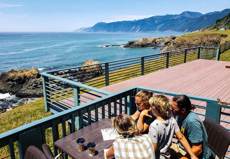
Just a little further on from Black Sand Beach (like a 2 minute drive on) is the delightful little fishing village of Shelter Cove.
It’s very rare to find such a beautiful small coastal town like this, especially in California, that has not been discovered and full of people and development.
This time we enjoyed the views with a nice latte on the deck from the café in the Inn on the Coast.
You’d never know it was there unless we caught sight of the small sign advertising coffee as we pulled into town. It’s worthy of a stop for sure. They also sell alcohol if you would want something stronger.
The Inn of the Lost Coast looks a fantastic place to stay and we all eyed off the hot tub we saw on the deck. I would definitely stay in this town for a quiet getaway.
There is a small beach cove and tide pools here that is said to be safe to put your toes in; the only safe one in the region. Be sure to check with a local first just to be sure.
At the other end if the cove is an RV park and General Store that also has food.
I recommend you stay here for the night, before continuing back up the rest of the loop the next day.
Stop 9: Sinkyone Wilderness State Park
If you have time, and want to extend your road trip, you can drive on to Sinkyone Wilderness State Park, which is an hour’s drive South of Shelter Cove.
We ran out of time to do this, but it’s a popular place to admire the windswept vistas of the Lost Highway Coast. It’s known for being home to elk, sea lions, and Gray whales pass the shores here in the winter.
The landscape is made up of canyons, rocky beaches with tide pools, sea stacks, and wildflower meadows.
Many people hike from here all the way up to Ferndale, passing along the fifty mile Lost Coast Trail through the King Range. This multi day trek is on our bucket list for California – one to come back for!
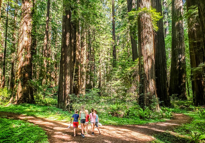
Stop 10: Humboldt Redwoods State Park
Now it’s time to explore what is said to be the heart of redwood country containing the biggest and best collection of giant coastal redwoods anywhere in the world covering more than 53,000 acres of pristine virgin forest along the Eel River.
The park is internationally renown and is classified as both a World Heritage Site and an International Biosphere Reserve.
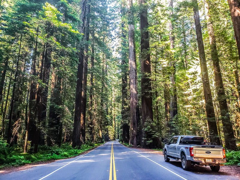
After Shelter Cove, we twisted and turned back out to begin the final part of our Lost Coast road trip, the Avenue of the Giants.
Avenue of the Giants
 Avenue of the Giants, Northern California
The Avenue of the Giants is a 31 mile scenic road that snakes through the Humboldt Redwood State Park between Phillipsville (south) and Pepperwood (north).
It’s renowned for the soaring redwoods standing guard along the road and welcoming you. And I mean it when they are standing alongside the road.
You could reach out your window and touch them and you need to be careful you don’t side swap them with your mirrors.
These are some of the most majestic and beautiful trees you’ll ever see. I quickly fell in love with the enigma of the tallest living thing on the planet.
Being in a redwood forest is a mystical and humbling experience. Their size naturally lets in little light so the world you ware walking in is cool and thick and covered in ferns and lush forests of green.
You just feel completely wrapped in up the presence of the infinite. It’s deliciously good for the soul and spirit.
Humboldt Redwood State Park has the largest remaining old-growth redwood forest in the world with more than 17,000 acres of ancient coast redwood and Douglas-fir trees.
There are plenty of places to stop along the way and hiking trails to experience the redwood groves.
Note: We got off the 101 highway near Phillipsville where the sign said Avenue of the Giants alternate route. I don’t recommend this stretch between Phillipsville and Myers Flat as there wasn’t much to see. It would have been quicker to stay on the highway and get off at Myers Flat and begin the Avenue of the Giants at the Shine Drive Thru tree.
Below are the stops we made on the Avenue of the Giants and in Humboldt Redwood State Park and can recommend.
The Shine Drive Thru Tree
The Shine Drive Thru tree is the tourist trap of the Redwoods in Northern California. It’s a gigantic opening in a redwood that a small car can drive through, There are also walk through trees for kids.
Our Beast (Ford F250) was too big to drive through the tree. It’s only 7’ by 7’ opening so we couldn’t do it.
The Drive Thru Tree is a little pricey at $10 a car or $3 to walk through so you want to be sure its worth it.
We decided not to walk through and continued driving.
Nature Trail opposite Visitor Center
The visitor center is on the Avenue of Giants and includes the beautiful and serene state-run campground.
There is a beautiful Gould Grove Nature Trail opposite and an easy 0.6 miles loop trail featuring 300′ tall trees, evidence of early logging, and easy access to the river via a spur trail and flat.
Founders Tree and Dyerville
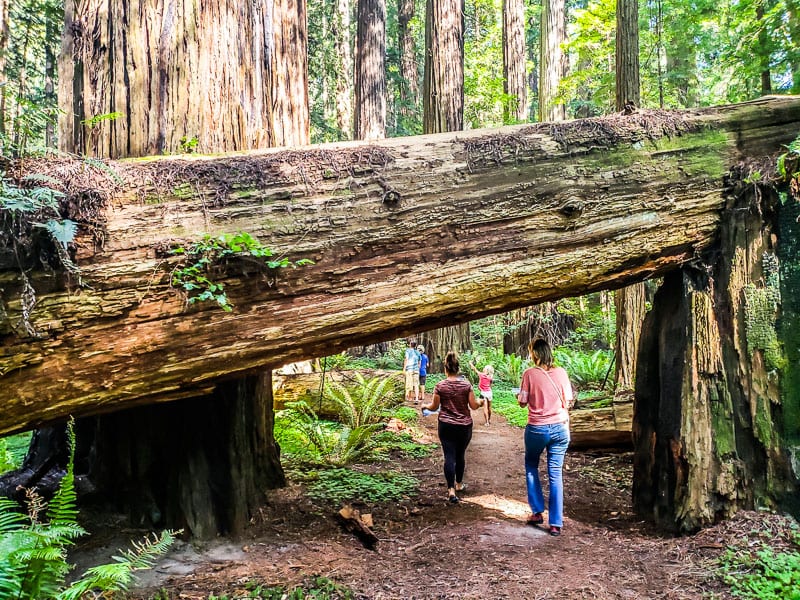
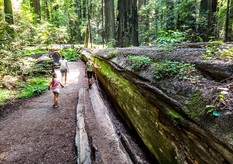
The Founders Grove is a collection of trees worth visiting in the Humboldt Redwoods State Park.
A half-mile nature trail takes you past the 362 foot tall Dyerville Giant. It was said to be one of the tallest redwood trees (and possibly 2,000 years old) before it fell in 1991.
You can now see the gigantic fallen trunk laying across the forest floor, which will give you a small perspective of just how big these trees are.
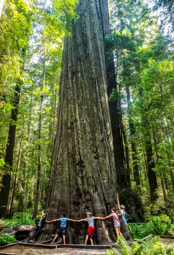
Be sure to enjoy the Founders Tree in the middle of the trial. It’s gigantic and took 10 of us to wrap our arms around it!
Giant and Iron Tree
In the Rockefeller Forest, west from Founder’s grove along the Avenue of the Giants is one of the largest old-growth forests in the world and include the two world champion trees, Giant and Iron Tree, reaching over 360 feet and 17 feet in diameter.
This is a pretty area and walk that is worth doing and also includes a creek crossing.
Other loop walks near here that came highly recommended was Rockefeller Loop just near the S. Fork Eel River. We ran out of time to do this one.
Stop 11: Cheatham Grove
If you want another gorgeous redwood grove to walk through, be sure to visit Cheatham Grove.
You will have this place all to yourself. You won’t be able to see the floor of the forest so thickly covered in ferns and redwood sorrel. There is a short mile loop walk you can do here.
You can grab a scavenger hunt brochure for the kids, in particular older kids. I felt it was too wordy for ours to connect to it and enjoy it. They just wanted to walk and play with each other there and have pretend Darth Vader stick fights.
Why Darth Vader? Because in Cheatham Grove, parts of the Star Wars movie Return of the Jedi was filmed here.
Stop 12: Swim in the Eel River
If it’s hot, and you have time, on your way back to Ferndale I’d recommend finding a swimming spot along the Eel River.
The South Fork of the Eel River provides excellent opportunities for fishing, boating, picnicking, and swimming
We didn’t do this, but we did stop in at the Eel River Brewing for a bite to eat and some drinks.
If you do the shorter Lost Coast drive (which I don’t recommend as you’ll miss Black Sand Beach) then you’ll have time.
Unless you visit Black Sand Beach and Shelter Cove on a separate day, which may be a good option and give you more time in Shelter Cove. You could even stay a night or two there.
Lost Coast and California Redwoods Map
You can follow this loop road trip by following the map below…
Where to stay for a Lost Coast Scenic Drive
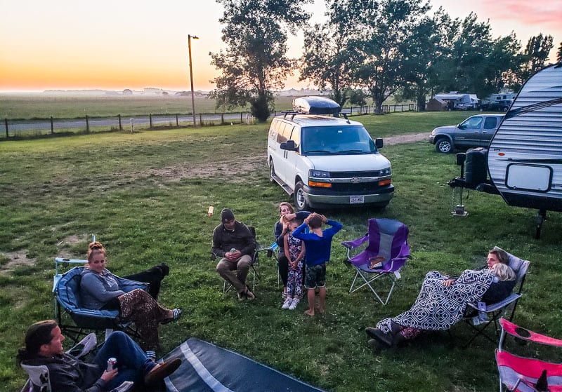
We camped at the Humboldt County Fairgrounds in Ferndale. It was an easy walk or bike ride into town and reasonable prices.
Otherwise, you can stay in the following accommodation options in Ferndale:
And the following places in Shelter Cove:
Video: Lost Coast Road Trip
You can watch our adventures on the Lost Coast Scenic Drive in the following video…
RV Rental California
More California Travel Tips
Pin To Save To Pinterest

Източник за тази статия
Наши спонсори са:
Български трактори на добри цени при изключително качество