Table of Contents
Most of the winter hikes in Ontario described below offer a magical escape into snow-covered forests, past frozen waterfalls, and scenic lookouts – and all are within a two hour drive of Toronto. Examples include the Vista Trail in Rouge National Park with its sweeping views of the Rouge River Valley, while the Niagara Glen area features rugged trails winding past massive truck-sized boulders with stunning views of the Niagara River. For a mix of open woods, undulating ridgelines and frozen waterfalls, Short Hills Provincial Park near St. Catharines is a great choice. Rattlesnake Point Conservation Area delivers some lovely Niagara escarpment views and access to the Bruce Trail,
Closer to Collingwood the Nottawasaga Bluffs Conservation Area offers peaceful trails along the escarpment, with stunning viewpoints while Mono Cliffs Provincial Park boasts a short scenic gorge and a pretty overlook. Pick a section of the 34-kilometre Georgian Trail, a route from Collingwood to Meaford, and enjoy a winter hike or snowshoe along the Georgian Bay’s icy shoreline.
Whether you’re looking for a short scenic winter hike or a snowshoeing adventure, these trails showcase the beauty of Ontario’s winter landscape.
This post includes some affiliate links. If you make a qualifying purchase through one of these links, I will receive a small percentage of the sale at no extra cost to you. Thank you very much for your support.
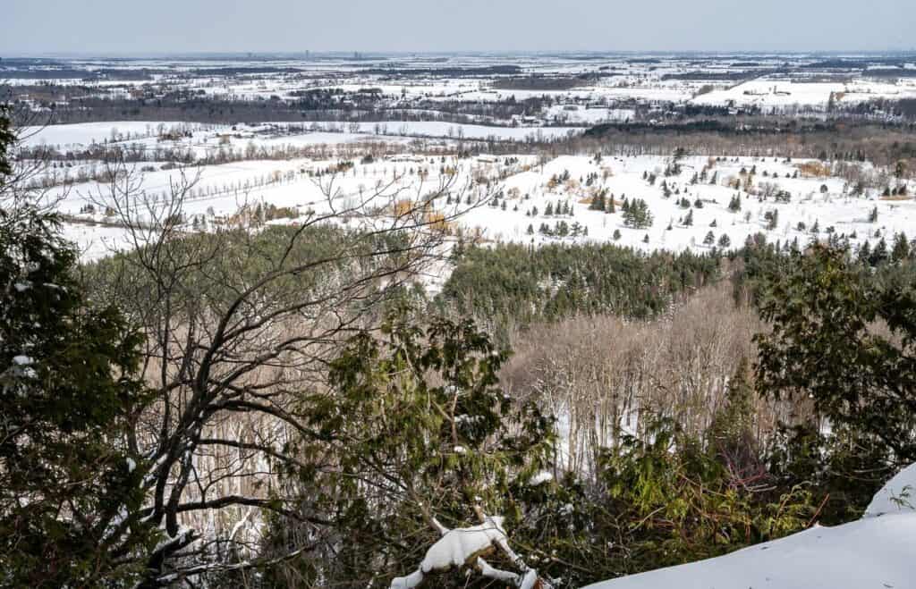
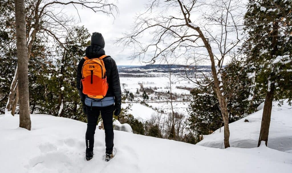 The view from one of the scenic lookouts in Rattlesnake Point Conservation Area
Location map of winter hikes in Ontario
What you should know about parking before you do these winter hikes in Ontario
Before you head off on any of the winter hikes in Ontario, be sure you know what the deal is with parking and booking timeslots in both provincial parks and conservation areas. Sometimes the parking is free, but the entrance is not or vice versa. Often, you’ll need a bar code on your phone to get either in or out of the parking area.
Some places like the Mount Nemo Conservation area were a real pain – as there was no cell signal near the parking lot. We had to head back towards Burlington to get one and reserve a spot – even though as you can see below, the parking lot was empty. Then, if you miss the time slot by five minutes, you need to wait – at least in theory for another 25 – 30 minutes to get in. At least at the Rattlesnake Conservation area, it read our license plate and let us in earlier than what I had booked.
In some cases, you will have to choose the number of hours you plan to visit. I find that to be incredibly difficult to do when it’s a new area I’m keen to explore. You’re best off paying for a full day, so you’re not rushing to get back to the car.
 We are the only car in the parking lot at Mount Nemo Conservation Area but holy hassle trying to get in!
What to take on winter hikes in Ontario
Dress in layers: Layer up with merino wool tops and bottoms, possibly a down vest depending on the temperatures, a fleece, a neck warmer, a hat, mittens and a winter coat. It would be worthwhile to carry toe warmers and hand warmers. The Ignik brand that MEC is carrying are particularly good.
Dogs: Dogs on leash are permitted on most trails save the ones at Scenic Caves Natural Adventures. Many dogs will not like the descent to the Niagara Glen trails as the stairs are see-through. Please pick up after your dog. We saw way too many fresh poops on the trails in almost every park and conservation area we visited.
Pack: Always take the 10 hiking essentials. I’d suggest hiking poles, microspikes, and snowshoes if you need to break trail.
Please: Practice the seven Leave No Trace principles.
Maps: Take a picture of the trail map at the trailheads. I’d also suggest an offline hiking app. My favourite is Organic Maps.
Recommended read: 15 Expert Winter Hiking Tips to Stay Warm & Safe
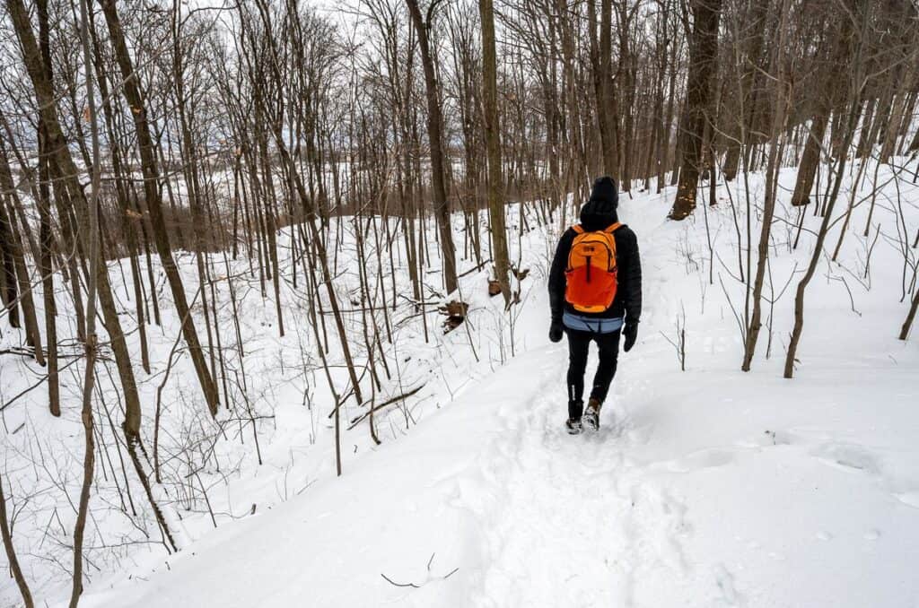
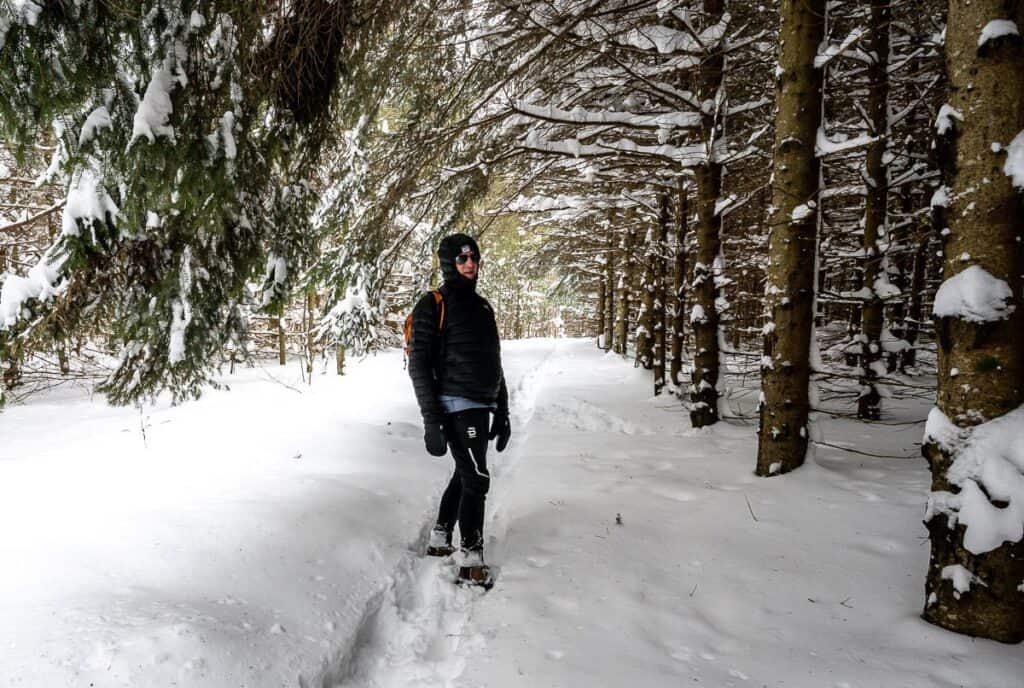
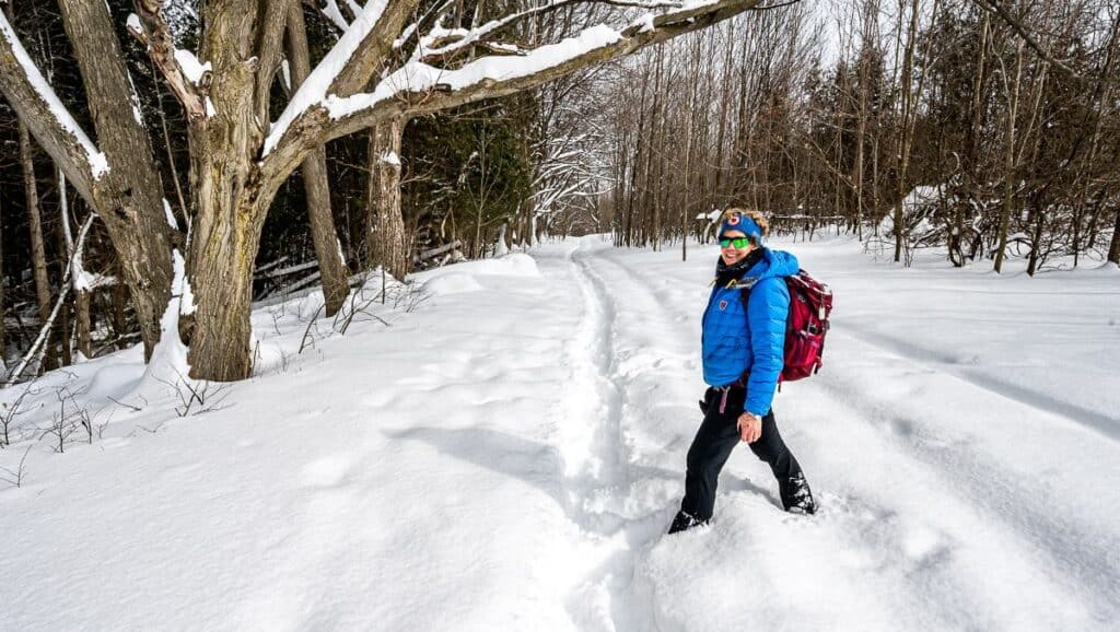 Me wearing warm clothes and carrying the hiking essentials in Mono Cliffs Provincial Park
Winter Hikes in Ontario in the Niagara region
1. Niagara Glen Trail
Location and parking: The Niagara Glen trail starts here. Paid parking by the Niagara Glen Nature Centre. You can pick up a trail map from the centre.
My rating: 10/10 – Very scenic and worthwhile with lots of variety.
Time needed: One to three hours depending how many trails you do.
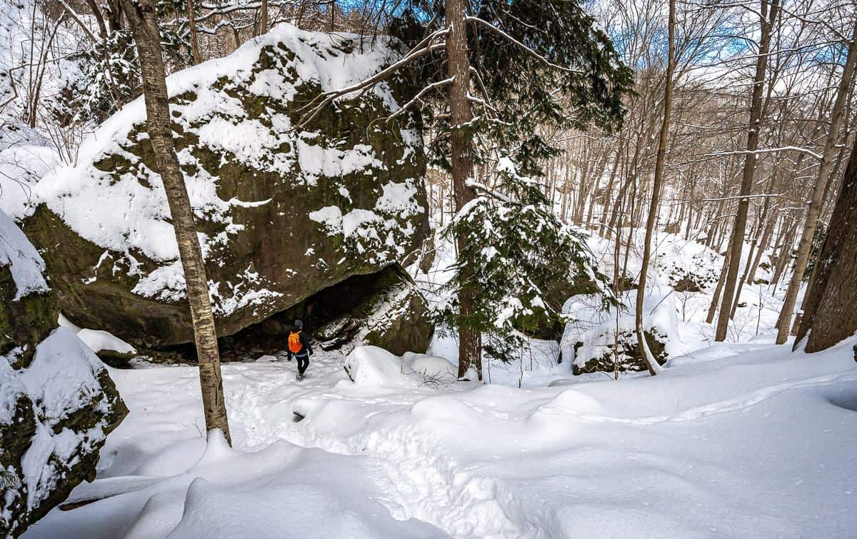
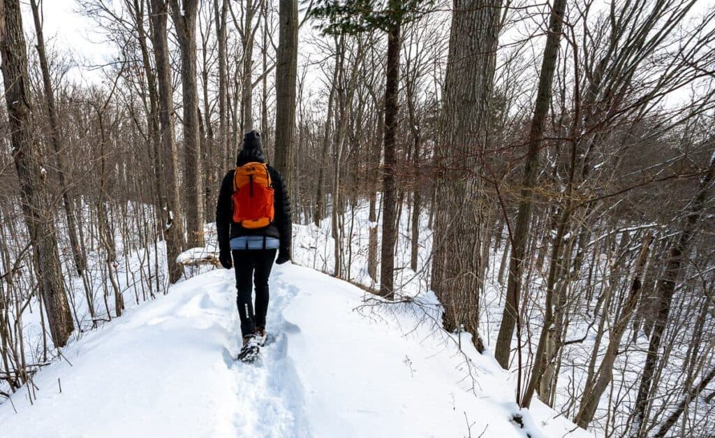
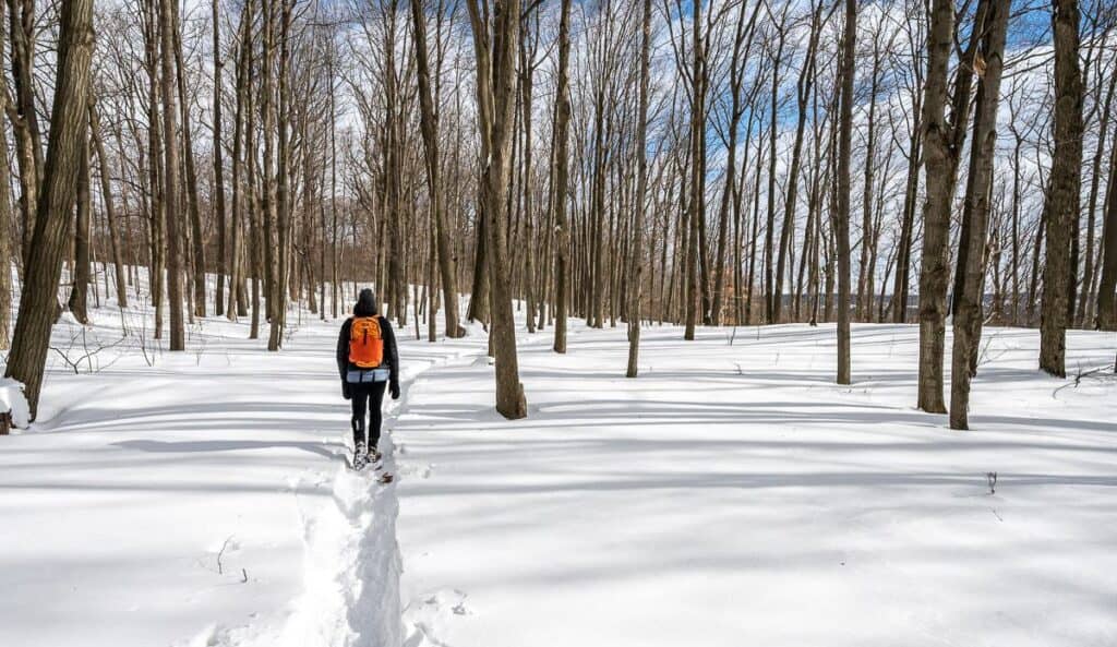
Experience: The trails in the Niagara Glen far exceeded my expectations. To access any of them, you’ll need to descend 80 steps from an airy lookout tower, located a short walk north of the Niagara Glen Nature Centre.
We hadn’t expected the beauty or variety of trails. We followed the 2.1-km-long Main Loop Trail and did an 850m side hike along the River Trail for downstream views of the Niagara River. Along the way we passed massive truck-sized boulders, hiked through pristine pockets of the Carolinean Forest and enjoyed great views of the fast-moving Niagara River as we looked across to New York State on the far bank.
What we missed was the 3.8 km return hike to the Niagara River Whirlpool. It’s reportedly a more difficult trail, but it would have been great to see it up close if we’d had the time.
 A look at the trail at the bottom of the cliff from the stairs in Niagara Glen
 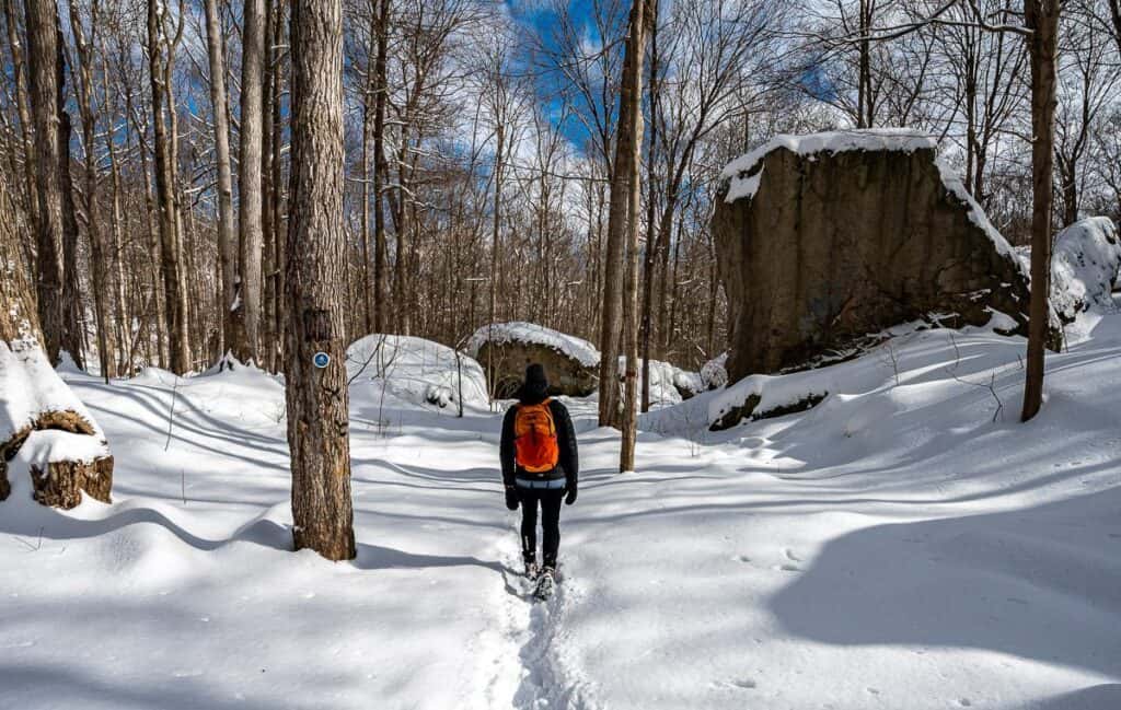 Glorious hiking on the Main Loop trail in Niagara Glen – one of the top winter hikes in Ontario
  Microspikes come in handy on the ice sections in the shade on the Niagara Glen trails
 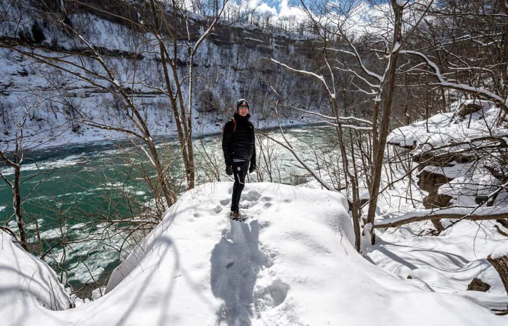 A pretty Niagara River backdrop on one of the premiere winter hikes in Ontario – the Niagara Glen trail
 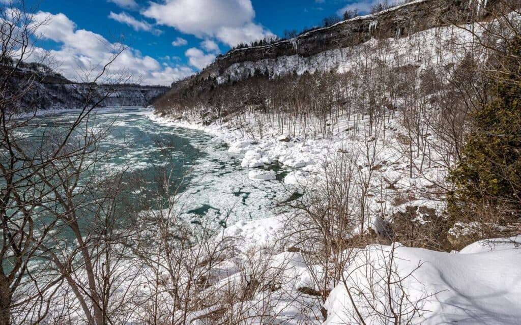 Looking up the Niagara River towards Niagara Falls
 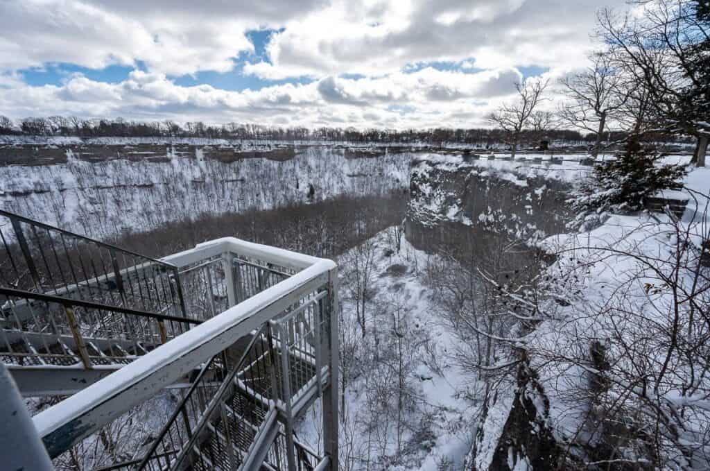 You must decide 80 stairs to get to the Niagara Glen trails
2. Short Hills Provincial Park – one of the top parks for winter hikes in Ontario
Location and parking: Located between Fonthill and St. Catherines. There are three parking lots and all are free.
1. Pelham Road Parking Lot(Main Lot) at 2851 Pelham Rd, St. Catharines – This is the most popular and largest lot with access to the Black Walnut Trail.
2. Wiley Road Parking Lot – end of Wiley Rd, off Effingham St, Pelham. It’s a less crowded, smaller lot that provides direct access to the Swayze Falls Trail.
3. Roland Road Parking Lot – off Roland Rd, east of Effingham St, Pelham. This is a good alternative if you want to explore the more remote areas of Short Hills Provincial Park.
My rating: 8/10 – Lots of pretty terrain, waterfalls and ridges. Great for families.
Time needed: One to three hours depending on how many kilometres you opt to hike. There are about 23 km of trails in total with lots of loops possible for variety. For winter hikes in Ontario, Short Hills Provincial Park is a great one to explore.
Experience: Twelve Mile Creek sliced through sedimentary deposits and glacial till thousands of years ago forming the short hills you see on any hike in the park today.
As a result, there’s lots of up and down – but what I particularly liked was the ridge walking and the sheer size of many of the hardwoods trees. We spent a couple of hours hiking here, mostly on the Black Walnut Trail, but unfortunately missed Swayze Falls – a highlight for most visitors.
 Delightful ridge walking on the Black Walnut Trail in Short Hills Provincial Park
 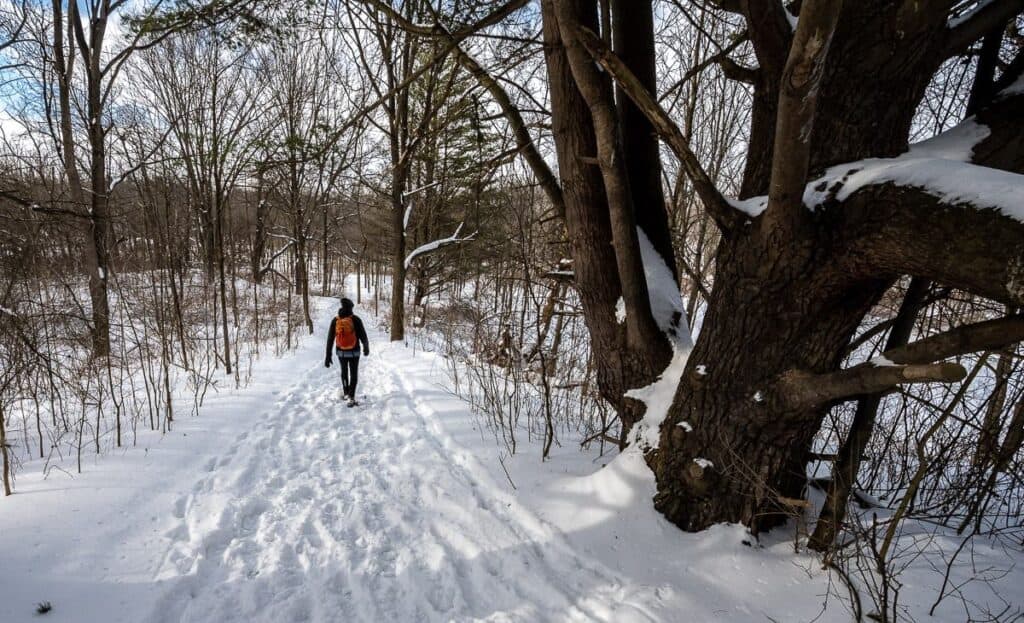 Look at the size of this tree in Short Hills Provincial Park
 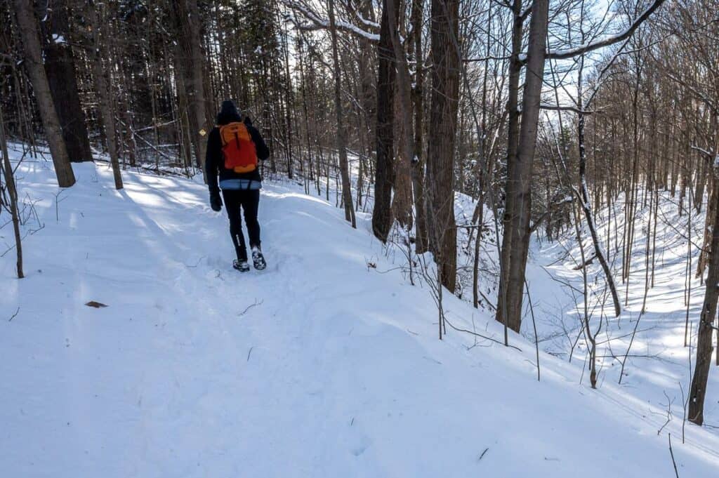 Loved the hills and ravines in Short Hill Provincial Park – a fun place in Ontario for winter hikes
  Lots of hardwood trees in the forest
3. Woodend Conservation Area
Location and parking: 1 Taylor Road, Niagara-on-the-Lake or here on Google maps. Lots of space for free parking just off Taylor Toad.
My rating: 3/10. Fine if you live in the area but I wouldn’t make an effort to visit
Time needed: One hour.
Experience: If you’re looking for a short peaceful escape on the Niagara Escarpment, then a hike through the hardwood forest in Woodend Conservation Area would be a fine choice. Everyone we met seemed to be a local out for a dog walk. There aren’t many trails, but we were able to do a loop by starting in the trees and returning on the road.
 A section of trail in the Woodend Conservation Area with peek a boo views of vineyards
  The road was just plowed after a large snowfall, making the walk through the conservation area quite pretty
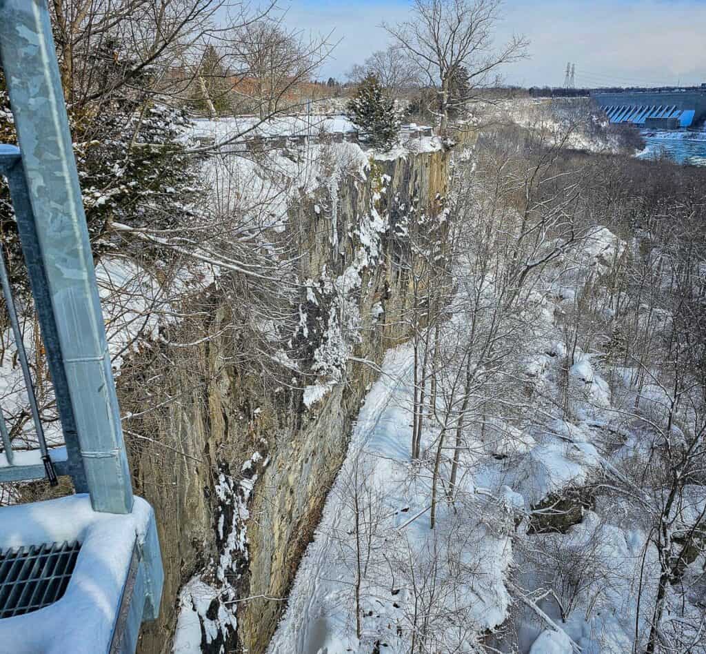
4. Devil’s Punchbowl Conservation Area
Location: Off Ridge Road west of Fruitland.
Parking: Bad signage. You must drive right up to the gate, and it lifts – but it doesn’t say that. Purchase a ticket for $8.50 (expensive considering we were there for 15 minutes) and use it to get out.
Hike classification: 1 – 2/10: Skip this one if you’re heading to the top of the Devil’s Punchbowl. It would be much more interesting hiking from the Bruce Trail Devil’s Punchbowl Side Trail though the website says the 1.2 km long trail is officially closed because of safety concerns.
Time needed: 15 minutes
Experience: A very short hike takes you from the parking lot to the William Sinclair Memorial Cross where you’ll get a good view from the Niagara Escarpment. Walk back to the parking lot along the Bruce Trail Side Trail to get a view of the Devil’s Punchbowl Upper Falls. Circle back to your car.
If you’re in the area, this would be fine to stop and see, but I wouldn’t recommend making a big detour to see these falls. And it’s certainly not much of a hike – more like a stroll.
 The pay machine is on the far side of the gate at the Devil’s Punchbowl Conservation Area
  View over the Niagara Escarpment from the William Sinclair Memorial Cross
  The Devil’s Punchbowl
  View from the road over Devil’s Punchbowl
Winter hikes in Ontario near Collingwood
5. Mono Cliffs Provincial Park
Location: The parking for Mono Cliffs Provincial Park is located at 795086 3rd Line EHS near Shelburne.
Parking: You need to reserve a time slot to enter Mono Cliffs Provincial Park, and the cell signal is weak. I’d recommend doing it beforehand – and choose the full day option if you don’t want to be rushed. You will need a bar code to enter.
Hike classification: 8-9/10. Lots of variety, with views, 30-metre cliffs, a scenic canyon, and a picturesque section of the Bruce Trail.
Time needed: 2 – 5 hours depending on how keen you are – or in our case, how deep the snow was.
Experience: One of the top winter hikes in Ontario takes you from the main parking lot to a canyon and scenic overlook via snowy trails through a forest of beautiful cedars and maples.
We did a combination of trails – including the Carriage, Spillway, Walter Tovell, and the Cliff-Top Side Trail. We broke trail for most its length – and then broke it again on the return because it was snowing so heavily. The highlight for us, apart from the gorgeous forest, was the short scenic gorge accessed via a couple of sets of stairs. And I can well imagine the view over the small lake would be quite magical on a sunny day.
 There was lots of snow in Mono Cliffs Provincial Park
 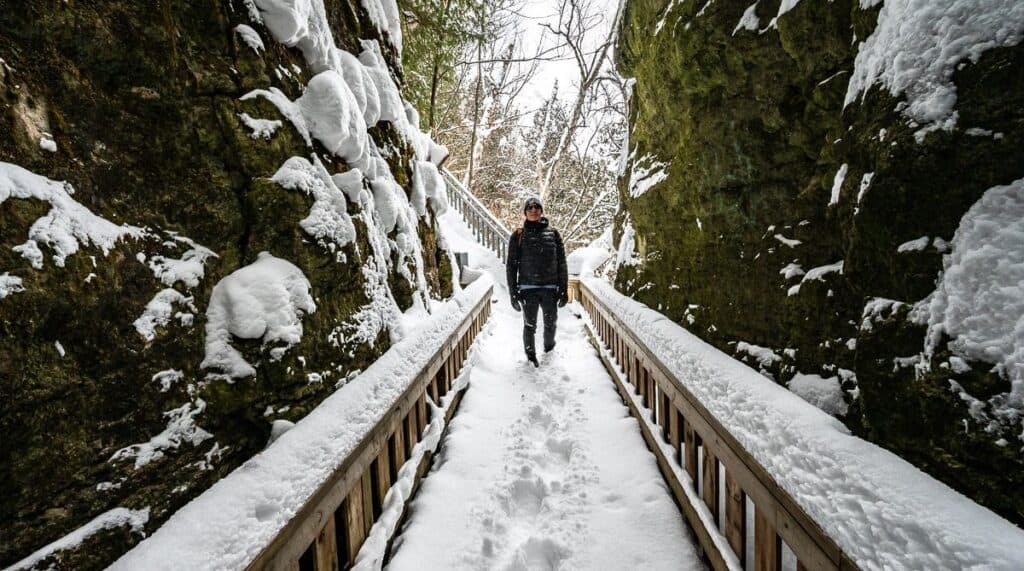 Descend stairs off the Cliff-Top Side Trail to enter a small canyon – one of the fun winter hikes in Ontario
 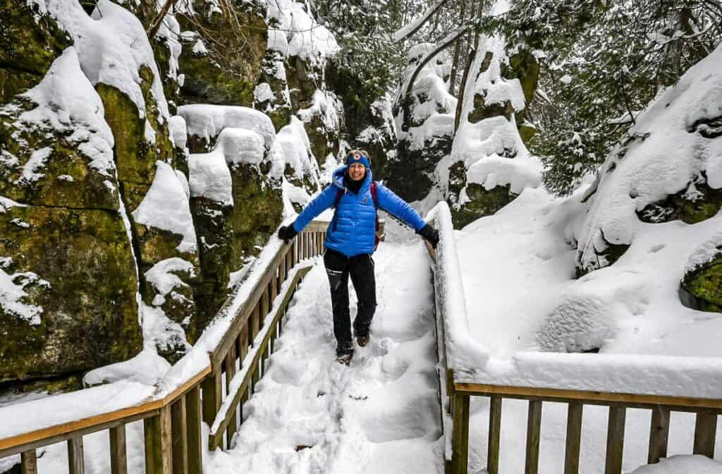 Me in the scenic gorge on a very snowy day in Mono Hills Provincial Park – one of the exceptional parks in Ontario for winter hikes
 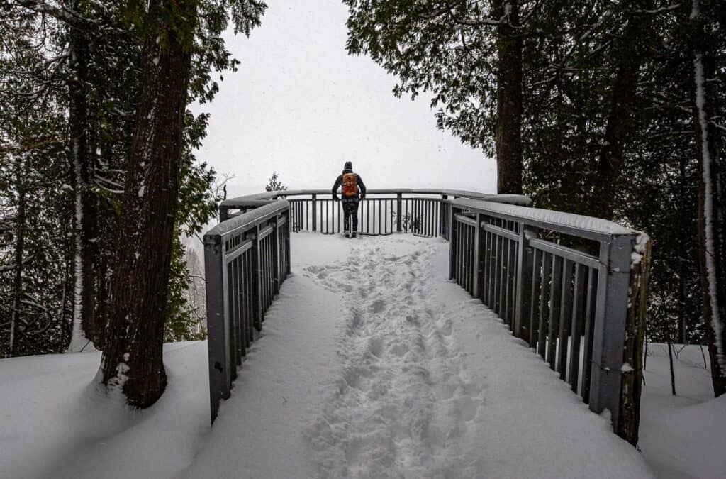 Not much to see from the viewing platform on a winter day in Mono Cliffs Provincial Park
6. Scenic Caves Natural Adventures
Location: Scenic Caves Natural Adventures is accessed from the same road as Blue Mountain Resort but the turnoff is earlier. It’s about a 15-minute drive from downtown Collingwood. On Google Maps it is here.
Parking: Free outside the main building.
Hike classification: 10/10 – A wonderful winter wonderland with 12 km of well-marked snowshoeing trails. Views of the Georgian Bay, a suspension bridge and beautiful woods are a highlight.
Time needed: 2 – 4 hours depending on your pace and how many trails you snowshoe.
Experience: John and I arrived at the Scenic Caves Natural Adventures on a very snowy Saturday in February. The views were compromised but the snow conditions were first rate. We snowshoed a big loop on the outer trails of each smaller loop to do about 9 km in total. We broke trail through almost knee-deep snow at times, so we got a great workout.
I loved the scenery on the Enchanted Forest , Paradise, Oh Deer trails and of course the suspension bridge is a highlight. Post snowshoe outing we warmed up by fires near the main building. You can book a sauna too – which would help with any muscle aches – and be a nice way to relax.
Rent snowshoes onsite and cross-country skis too. The Nordic trails looked inviting too.
 The suspension bridge at Scenic Caves Natural Adventures is always a highlight
  The Enchanted Forest absolutely lived up to its name on a snowy February weekend
 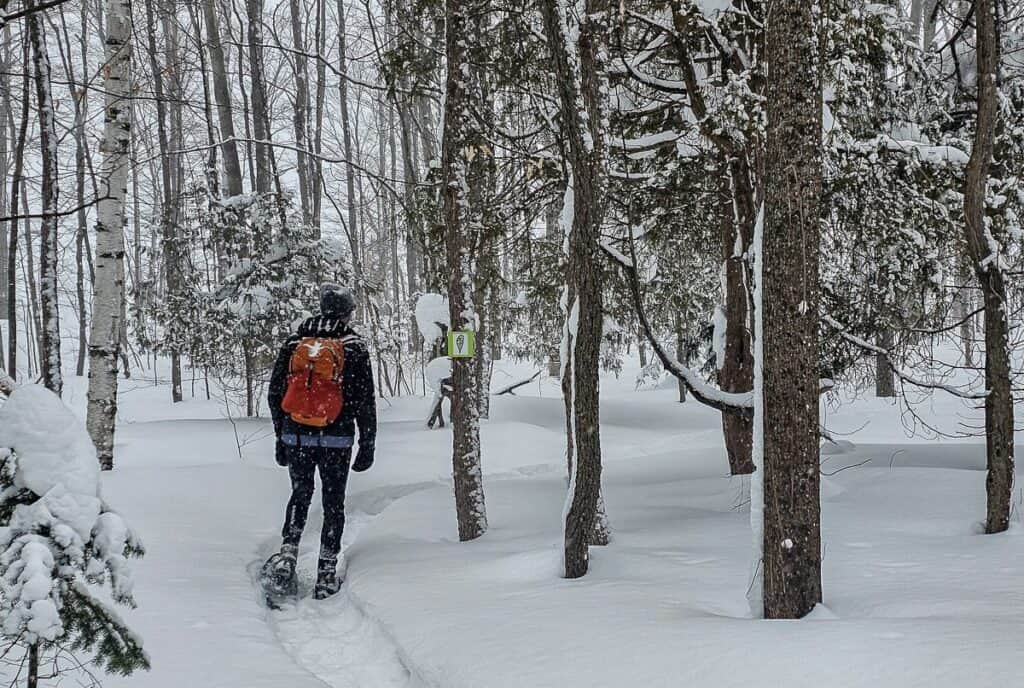 There are about 12 km of beautiful well-signed snowshoe trails at Scenic Caves Natural Adventures
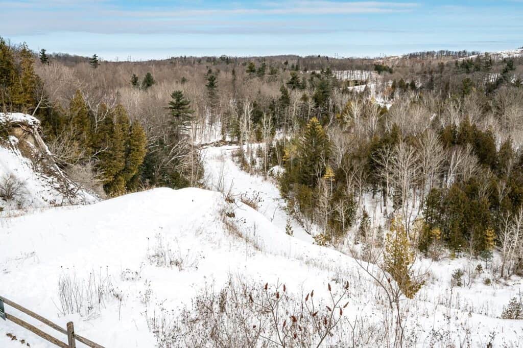
7. Nottawasaga Bluffs Conservation Area
Location: 8861 Sideroad 15 & 16 Nottawasaga, Glen Huron and here on Google Maps.
Parking: You can purchase a parking pass at the parking lot or beforehand through the HotSpot website.
Hike classification: 7-8/10 – and probably higher if we’d been able to do the Keyhole Side Trail – and if we’d included the Bruce Main Trail hike.
Time needed: 1.5 – 4 hours depending on how far you want to hike.
Experience: The 400-acre Nottawasaga Bluffs Conservation Area is a beauty. While there is the option to do an 8.2 km outer loop that includes the Bruce Trail, we opted for a hike out to the escarpment edge – again through deep snow – with some side trails to change it up.
I’m sorry we missed the Keyhole Side Trail – one of the top sights in the conservation area – but nonetheless we enjoyed the beauty of the woods and the views from the top of the cliffs. With a lot of snow, pay close attention to your footing as it wouldn’t be hard to tumble down into one of the clefts near the cliffs.
We found the signage to be good but would still recommend taking a picture of the trail system at the kiosk by the parking lot.
 It felt like we were hiking through a tunnel of trees in the Nottawasaga Bluffs Conservation Area
  On a pretty section of the Bruce Main Trail – where you had to avoid the cliffs
 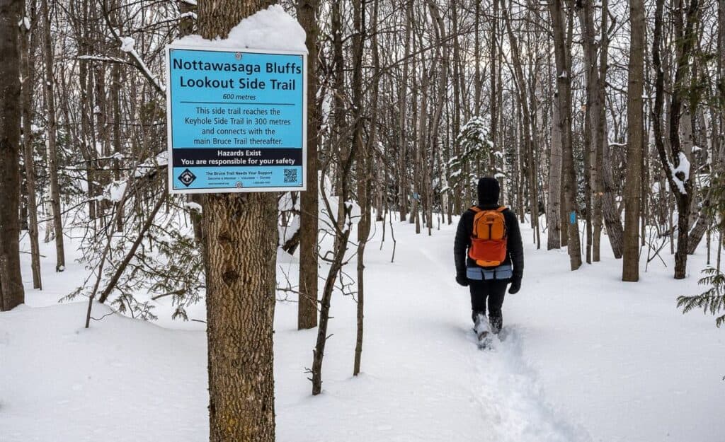 I kick myself that we ran out of time to the Keyhole Side Trail – and we were so close
  Exceptionally beautiful forest in Nottawasaga Bluffs Area – one of the most beautiful of the Ontario winter hikes we did
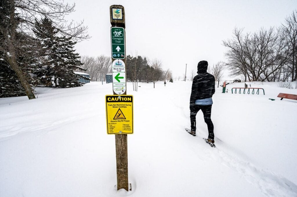
8. Georgian Trail
Location: A 34-kilometre stretch of former rail trail between Collingwood and Meaford.
Parking: There are 30 access points with parking available in Collingwood, Thornbury, and Meaford, as well as along various connecting roads
Hike classification: 8-9/10 A flat, easy trail to hike or snowshoe. Pick your starting point and enjoy Georgian Bay views and peaceful, snowy forests.
Time needed: A minimum of one hour.
Experience: With deep snow we didn’t hike much of the Georgian Trail, but what we did do, we loved. Snowshoes would have worked better on the day we tried it as there was at least a foot of fresh snow which added to the beauty of the area.
What you’ll get in winter on the Georgian Trail is a tranquil trail experience with on and off views of the Georgian Bay. Don’t miss a stop in Collingwood to see the stunning cultural pavilion called the Awen Gathering Place, built to acknowledge the presence and heritage of First Nations in South Georgian Bay.
 The Georgian Trail in Collingwood on a blowy snowy winter day
 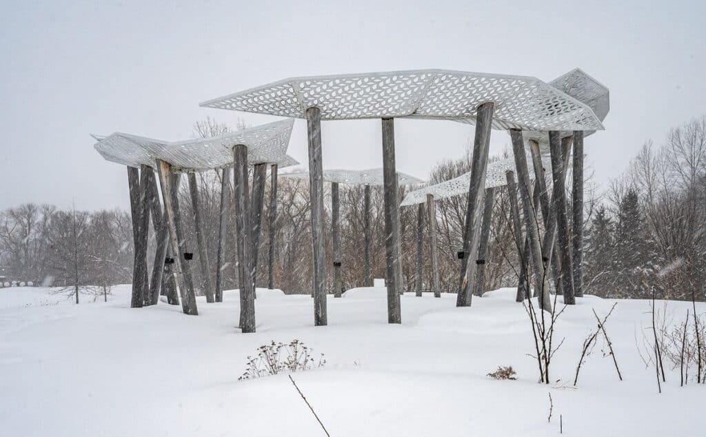 The Awen Gathering Place in Collingwood on the Georgian Trail
Winter hikes within a one hour drive of Toronto
9. Rouge National Park – one of the winter hikes in Ontario that’s easy to access from Toronto
Location: We parked at the Vista Trailhead off the Zoo Road.
Parking: Other parking lots in the national include Rouge Beach, Twyn Rivers, Bob Hunter Memorial Park and Glen Rouge Campground / Mast Trail. All parking lots are closed and locked at 9 p.m. daily for community safety.
Hike classification: 7-8/10 – lots of options with 50 km of trail.
Time needed: 60 – 90 minutes for the Vista Trail plus short add-ons.
Experience: The Vista Trail was our choice – partially on account of the parking. The highlight of the trail is the Vista Overlook, which offers a panoramic view of the Rouge River Valley. The forest walking was peaceful and beautiful with the only real downside the presence of hydro lines at the start of the hike. For a short outing it packs a punch.
 The view from the Vista Trail Lookout in Rouge National Urban Park
 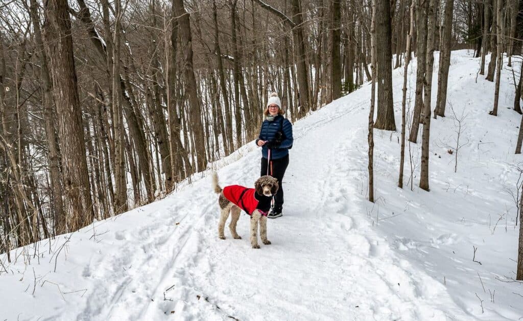 Peaceful winter hiking on the Vista Trail in Rouge National Urban Park
 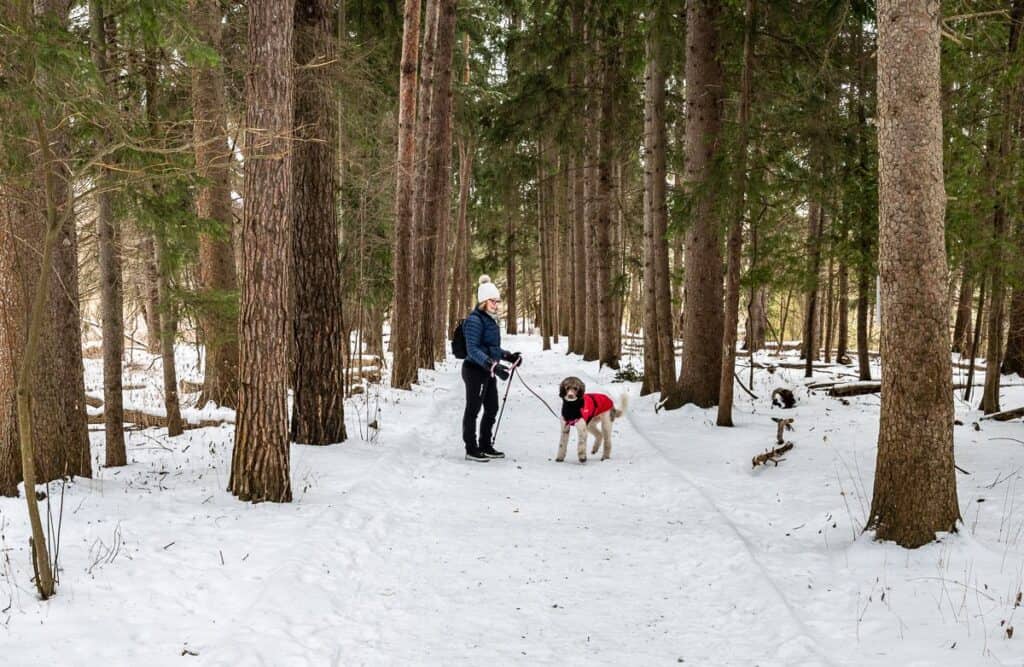 My sister-in-law and dog Betty on a tree-lined trail
10. Mount Nemo Conservation area
Location and parking: Just north of Burlington off Highway 1, also called the Guelph Line. There is also parking on Walker’s Line, but you’ll have to start on the Escarpment Edge trail.
Hike classification: 6-7/10 – Pleasant hiking, nice viewpoints but no wow factor in winter. A great place to come if you live in the area.
Time needed: The main trail consists of both the north and south loops and is about 5 km long. Allow approximately 1.5 – 2 hours at a moderate pace.
Experience: The Mount Nemo Conservation Area is less crowded and quieter than nearby Rattlesnake Point. Enjoy panoramic views from the top Niagara Escarpment, where on clear days you can see as far as Toronto.
Extensive forests explode in reds and oranges come fall – but in winter are simply very beautiful and peaceful. Overhead, you might see turkey vultures flying though we saw no signs of any wildlife.
 View over the Niagara Escarpment from the Mount Nemo Conservation area – one of the easy winter hikes in Ontario
 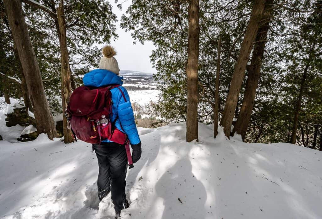 In winter especially, stay well back from the edge of the escarpment
 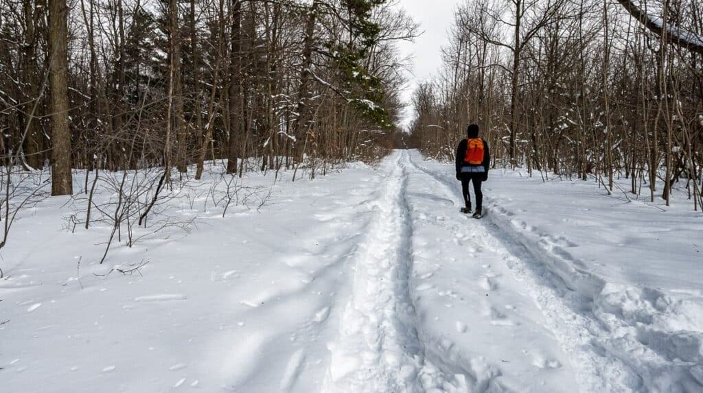 One of the pleasant and easy winter hikes in Ontario is the North Loop in the Mount Nemo Conservation Area
11. Rattlesnake Point Conservation Area
Location: 7200 Appleby Line, Milton and here on Google Maps.
Parking: Reservations are required. At this entrance a machine can read your license plate so it’s quick to get in.
Hike classification: 8/10. Very pretty hiking through open woods on the Buffalo Crag and Vista Adventure Trail.
Time needed: 2 – 3 hours depending on how many trails you want to hike
Experience: The Rattlesnake Point Conservation Area is a great destination for winter hiking. Highlights are the scenic views over the Niagara Escarpment and truly beautiful forest. It’s easy to combine the 3-kilometre-long Buffalo Crag Trail with the 1.5-kilometre loop on the Vista Adventure Trail.
 Beautiful open woods in Rattlesnake Point Conservation Area – one of the popular places for Ontario winter hikes
 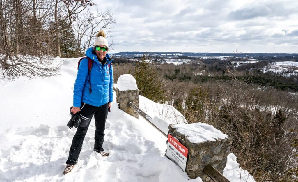 Views over to Mount Nemo Conservation Area from Rattlesnake Bluffs Conservation Area
More hikes in Ontario you might enjoy
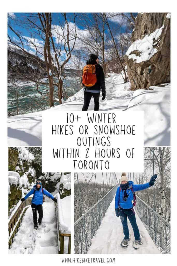
Click on the photo to bookmark to your Pinterest boards.
Източник за тази статия
Наши спонсори са:
Български трактори на добри цени при изключително качество